


|
You are at Home » Climbed Volcanoes, Intermediate Volcanoes 2000–3000 M » Gunung Salak
|
|


Gunung SalakMt. SALAK2210 MTHE VOLCANO WITH THE SWAMPS
By Handjono In a clear day we can see Mt Salak from our office when looking at the south direction. However some of CopiPanas members have not trekked the famous volcano although they have done many of other Indonesia volcanoes. This is weird because every day we spend at least 8 hours within its sight. The distance to Mt Salak from Jakarta is also pretty close in the vicinity of 60 km. Therefore one day we decided to trek it despite the spooky image of the volcano especially after the Sukhoi “Superjet 100” crashed in 2012 near the peak.
PROLOGUE
The real trek entry is about 1 km beyond the Cidahu Forestry Office, at the side of the luxurious Javana Spa Resort. After parking our car at the side of the resort security office we started the trek through the resort’s grass field.
THE ASCENT
In Mt Salak trek, starting from Pos-1 there are HM posts one every 100 m. So we can easily know how far we are from our destination, the peak. Leaving Pos-1 the real challenging trek began. Immediately the forest became thick and the swamps swallow the legs of them who were not cautious. Knee deep, the mud could retain your shoes inside it. Getting the shoes back is not particularly difficult but your arms would be black after poking into the mud. And then the ascents became steeper and steeper. Many parts were combination of rock and shale, slippery and tricky. We had to haul our bodies after grabbing tree roots or protruding rocks. At some parts of the trek the swamps appeared again. The knee deep muds were actually funny and not particularly dangerous. The worst that can happen would be slower pace and losing shoes. The trick is to step on the mud field edges where there were bushes.
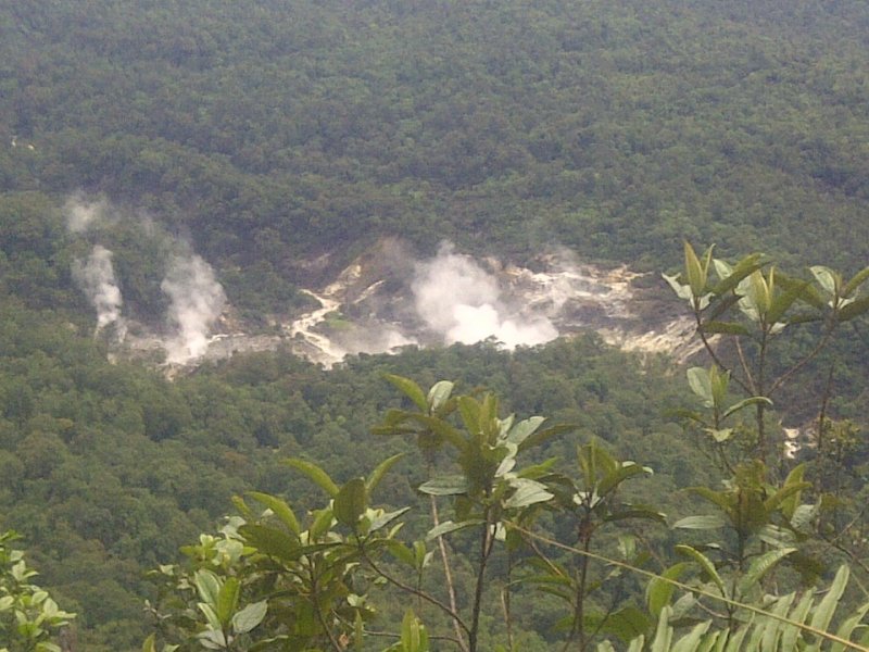
We did not want to spend much time over there and continued our hike towards the Puncak-1. The glimpse of the Puncak-1 has been seen amongst the pine trees. The Puncak-2 to the far left of the trek across the deep valley was overseeing us climbing slowly towards its sibling.
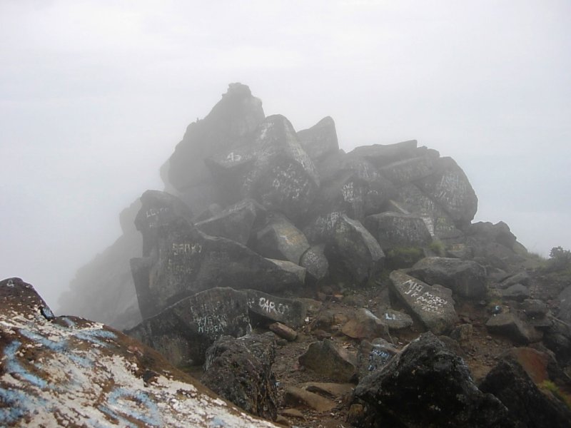
THE PEAK
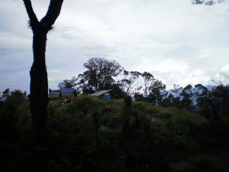
The once usable shelter from wooden structure near the tomb now has turned into a roofless structure. The tomb at the summit did not look ancient for it was made of porcelain tiles. We would have to bring a tent if we want to camp at the peak. Otherwise a bivouac of tree branches and leaves would do as the peak is indeed quite vegetated at 2210m. It was damp all over despite the clear weather, must be because of the rain a few hours before.
THE DESCENT By 17:00 we started descending to Cidahu, with the hope we already passed the HM 32 – 31 narrow strip before the sunset. It was actually right at the sunset when we passed the scary path. The yellowish last sunray of the day eased our souls for the journey to the basecamp along the tough trek. One by one the rope sections were negotiated and passed safely. Some sections actually caused bruises because we were handicapped by the darkness. Numerous slips happened and we walked down very carefully not to twist our ankles and not to lose our trek. At some points our guides stopped and returned after realizing the HM poles were missing. Luckily they always managed to find the right trek afterwards. The swamps were passed with better steps because we already learned from our mistakes during the day. Along the way we came across other hiker teams going up to the peak. Certainly we advised them to camp and to do the summit attack the morning after. Too risky to do it in the night. The full moon began to show its beauty when we were about to arrive at Pos-1. Its warm golden ray eased the wary hikers and slept me for a couple of minutes when taking a break at Pos-1. The hikers in the tent chatted in low voices but we could hear them planning the summit attack the day after. Then we marched the easy last trek towards the Javana Spa parking lot. The stone paved trek was very nice to our exhausted bodies. Pos-1 was HM 23 and by HM 1 we went straight i/o turning right. At the parking lot I was so happy when opening my car’s back door and pushing in by leather carrier.
Guides : Arif, Sujana
—ooOoo—
You can leave a response, or trackback from your own site. 3 Responses to “Gunung Salak”Leave a ReplyYou must be logged in to post a comment. |


get more info
“[…]Gunung Salak | CopiPanas[…]”
free summer camps san francisco
Gunung Salak | CopiPanas
what are progressive web applications
Gunung Salak | CopiPanas